
Northport ZIP Corridors Compared
The official USPS five-digit scheme groups 35473, 35475, and 35476 under Northport. City-published address examples help show their practical corridors, but they do not draw legal polygons. The Northport ZIP code directory therefore treats these descriptions as orientation. USPS confirms the postal line, and county or city records confirm jurisdiction.
| ZIP | Areas covered in official examples | Post office | Boundary notes |
|---|---|---|---|
| 35476 | Historic core; Main, Bridge, MLK Jr., McFarland, and Lurleen Wallace corridors | Northport facility at 4200 McFarland Blvd | Core city use, but not identical to the city line |
| 35473 | East and northeast; outer McFarland, AL-69, and Jones Road examples | USPS labels Northport; separate retail site not verified | Northport mailing territory reaches into broader county areas |
| 35475 | Northern Highway 43 and Rose Boulevard corridor | USPS labels Northport; separate retail site not verified | Extends far north where postal and city borders diverge |
A Northport city restaurant list includes a Northport business entry in 35480, but that is not enough to add 35480 to the core set. Exact Northport address checks can reveal exceptions. The three codes above are the defensible ZIP set documented by USPS, and no separate Northport PO-box-only or unique institutional ZIP was verified.
The USPS grouping source shows how the three Northport codes are organized.
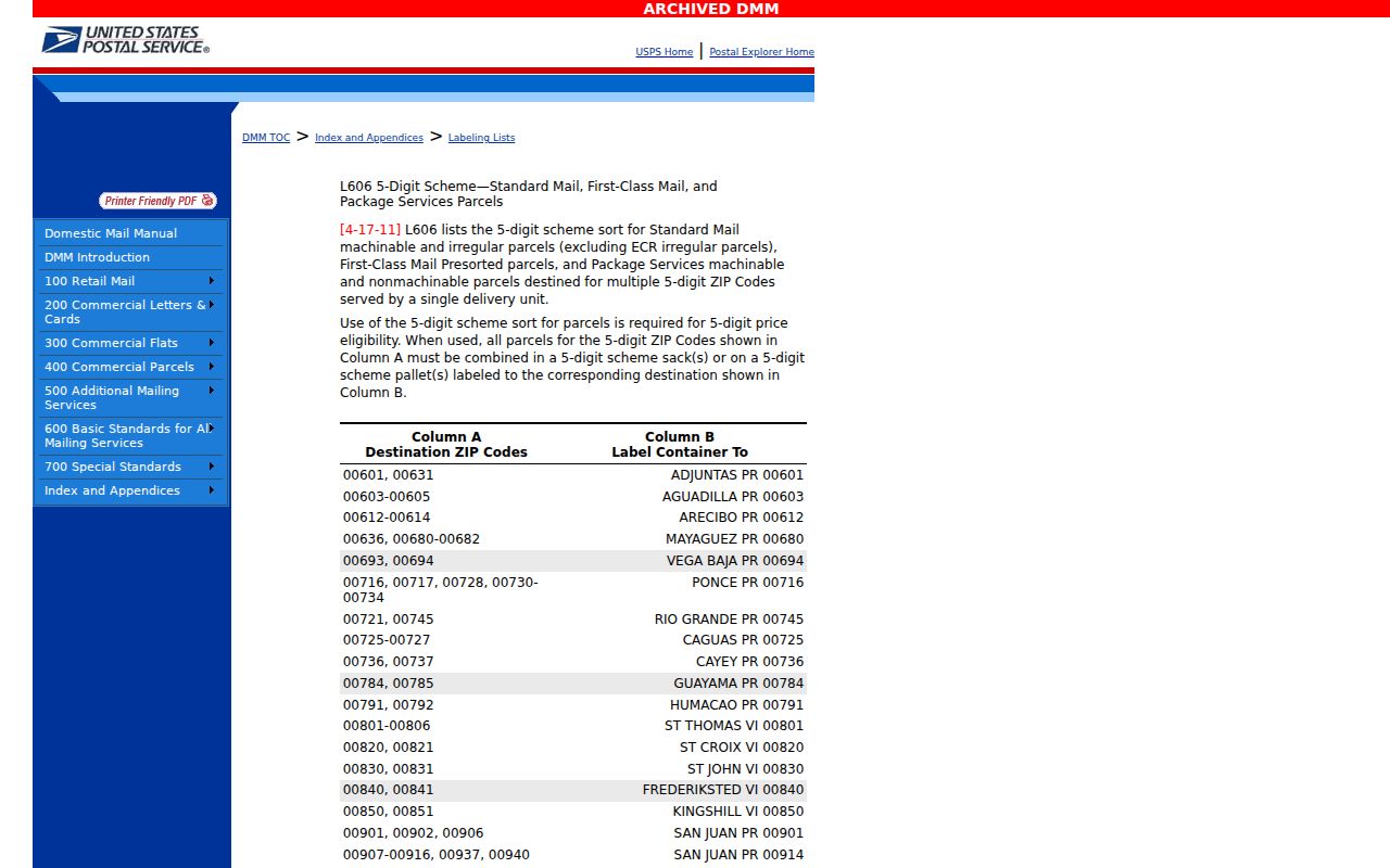
That Northport postal grouping is a reliable starting list, not a map of incorporated Northport.
Northport ZIP 35476 Anchor
The USPS Northport Post Office listing places the facility at 4200 McFarland Boulevard, Northport, AL 35476-2851. That makes 35476 the clearest physical postal anchor for the historic and southern commercial core. City Hall is also on McFarland Boulevard in 35476, reinforcing the corridor without proving that every parcel in the code lies within the city.
The two other Northport core codes need more care. Official USPS material labels both 35473 and 35475 as Northport, but the Northport research did not verify a separate retail post office for either. A ZIP code directory must not invent a station name or treat the absence of one as proof about delivery service.
The official facility record is the direct source for the Northport Post Office.
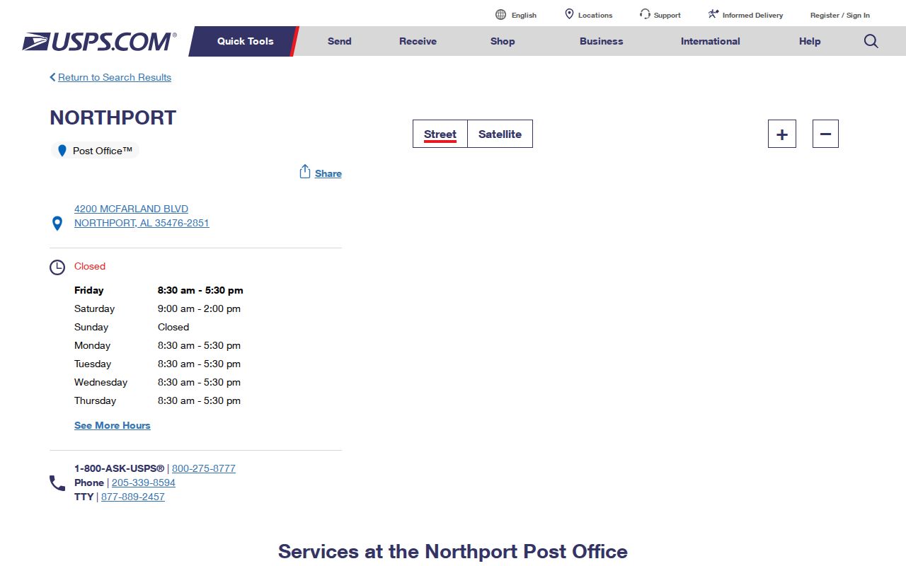
The facility address gives a verified ZIP+4 example and a firm reference point for checking nearby addresses.
Find Northport Residents by ZIP
A Northport ZIP code directory narrows geography, but no official system documented here offers a public list of all residents in one code. USPS checks one address. The Tuscaloosa County parcel search has no ZIP field. Alabama VoterView accepts ZIP as part of one residential-address lookup, not as a tool for browsing everyone in a code. Full voter-list requests allow county, city, and district scopes, but the posted form has no ZIP checkbox.
- Start with a complete street address and use the official USPS address lookup to verify its deliverable city, state, and ZIP.
- Search the physical street number and name in Tuscaloosa County Public GIS. Record the parcel ID and assessed owner without treating ownership as occupancy.
- Inspect the municipal or zoning layer, or ask Northport Planning & Inspections, to determine whether the parcel is inside city limits.
- Use VoterView only for an individual's own registration and polling-place check. Ask Elections staff whether a lawful custom geographic voter request is available.
- Once the ZIP search narrows to an address or named road, use the Northport street directory workflow for street-level records.
This process separates postal routing, parcel ownership, municipal status, and personal records. It also avoids a false claim that a ZIP-wide owner list is a resident roll. Owner mailing addresses may point away from the parcel, and other occupants do not appear merely because an owner does.
Northport ZIP Search Field Limits
Official Northport tools use ZIP data in sharply different ways. The key is to match the field to the Northport task. USPS is the authority for one deliverable postal line. County GIS supplies parcel and jurisdiction clues but cannot run the ZIP-wide query that many readers expect. VoterView uses a full address for self-service verification.
| Official tool | Input fields | ZIP role | What it cannot do |
|---|---|---|---|
| USPS ZIP Lookup | Street address, city, state | Returns the valid ZIP for one address | Does not prove city jurisdiction or identify residents |
| Tuscaloosa Public GIS | Physical number/name, parcel, PIN, owner, district, subdivision, acreage, value | No documented ZIP field | Cannot return a verified ZIP-wide parcel roster |
| Alabama VoterView | One residential address, including ZIP | Supports address geocoding | Not a ZIP-wide public voter browser |
| Voter-list request form | County, city, district and selected address fields | No posted ZIP checkbox | Custom ZIP scope must be confirmed |
When an online Northport portal lacks the needed filter, use its documented fallback. Call the relevant office, submit the correct request form, or search by physical address, subdivision, district, or parcel ID. Do not turn an unavailable ZIP filter into an unsupported claim about Northport coverage.
The USPS address lookup is the right portal for validating one postal line.
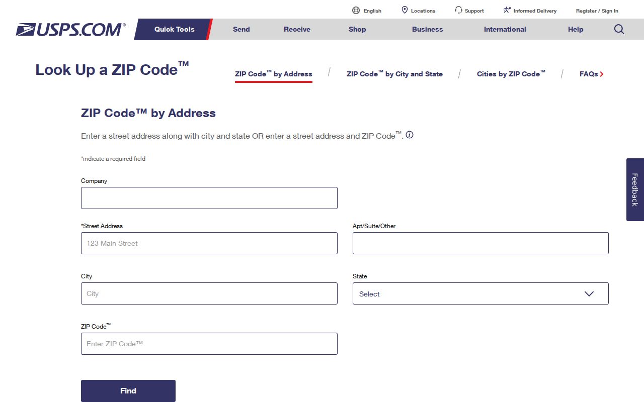
Its result should become one input to the parcel and city-line checks, not the final jurisdiction answer.
Northport ZIP Versus City Limits
ZIP codes route mail. Northport's boundary governs city status, services, and zoning. Those systems overlap but are not the same. A parcel can carry “Northport, AL” while sitting outside the incorporated city, especially along the outward reaches of 35473 and 35475. The practical corridor pattern places 35476 in the core, 35473 east and northeast, and 35475 north along Highway 43. It is not a legal border map.
The Census Bureau adds another layer through ZIP Code Tabulation Areas, or ZCTAs. These are statistical approximations built from census blocks. They may be noncontiguous and may model special postal points. A population count for ZCTA 35473, 35475, or 35476 is not automatically a population count for Northport city.
- ZIP and ZIP+4
- A ZIP is a five-digit delivery area. ZIP+4 adds a smaller delivery segment, as shown in the post office's 35476-2851 address.
- PO-box ZIP
- A code used mainly for post office boxes. None was verified as a separate Northport code.
- Unique ZIP
- A code assigned to one large organization or destination. None was verified for Northport.
- Carrier route
- A mail-delivery path within a ZIP. It does not define the city line.
- ZCTA
- A Census Bureau area made for statistics that approximates, but does not reproduce, USPS routing.
The Census Bureau's ZCTA explanation documents that distinction.
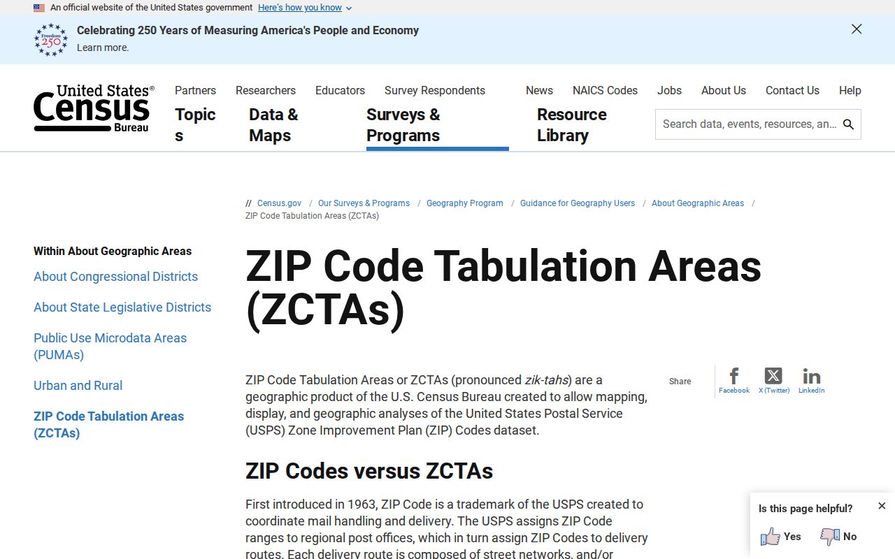
Using ZCTA totals as city totals would merge different kinds of geography and distort Northport research.
Keep Northport Parcels Stable
A ZIP or street label can change, but the parcel record provides a stronger bridge. Northport Planning & Inspections' address form handles new, changed, and other address requests. It ties the request to subdivision, lot, and parcel ID; asks what type of structure is involved; and asks which street a corner-lot front door faces. Supporting materials may be sent to the city's addressing email.
Alabama's 16-digit parcel format reflects township or range locator, area, section, quarter section, block, parcel, and subparcel. A property may carry more than one identifier because it crosses a section or joins land once held apart. Platted land uses subdivision and lot or block references, while some deeds rely on metes and bounds, a written boundary description based on courses and distances.
For a mismatch, validate the postal line with USPS, locate the physical address in county GIS, inspect city or zoning layers, and retain the legal description. Northport Planning & Inspections is the direct fallback when the portal cannot settle city status or a changed address.
Northport Growth Beyond Old Directories
Northport grew from 23,330 residents in 2010 to 31,125 in 2020, with a 2025 estimate of 31,648. That growth helps explain why northern and outer-corridor addresses in the Northport ZIP code directory may not appear in older downtown-era books. The absence of an address from a historic directory can reflect later development, not a failed name search.
Older books also predate ZIP codes and often identify a person only as “Northport.” Historical place names widen the search: Kentuck or Canetuck, North Tuscaloosa, North Port, and Northport all occur in local history. Tanyard Street is now 10th Street. Match those terms to maps, legal descriptions, and directory editions before carrying an old result into a modern postal search.
Note: Postal names help route a search, while a parcel layer and official city record settle the local jurisdiction question.
Use Northport ZIP Records Carefully
Official ZIP, parcel, voter, and directory records do not describe the same population. A property owner may live elsewhere. A mailing address can differ from the physical site. VoterView is an individual self-check, and protected information remains closed. Never infer a household member from a ZIP code or use postal geography to target, harass, or harm anyone.
Commercial neighbor tools may group names around a postal address, but their data can be stale, merged, or detached from official boundaries. USPS, Tuscaloosa County GIS, Northport Planning & Inspections, and the proper records custodian provide distinct facts that can be checked at the source. A careful Northport ZIP code directory search records which office supplied each fact and when it was retrieved.