
Walk a Northport Street
A reliable Northport by-address search moves from land to names. The physical address first points to a tax parcel. That parcel supplies a stable number, an assessed owner, and the subdivision or district needed to reject false matches. The deed then checks who acquired the same legal tract. Voter material and older books can add evidence of residence, but neither should be treated as a complete list of everyone inside a home.
- Enter the street number and name in the Tuscaloosa County Basic Search. Record the physical address, owner lead, parcel identifiers, district, subdivision, acreage, and value.
- Use the spy-glass beside the result to zoom to the parcel. Browse the visible parcel fabric and compare other results carrying the same street name.
- Check the latest deed. Search the owner as a buyer, then match the legal description and source-of-title reference to the parcel.
- Use voter information only through its lawful channel. VoterView is a one-person self-check, while a full list requires a formal request and does not cover every resident.
- For earlier households, test Tuscaloosa-titled directory volumes, census schedules, maps, and the deed chain. Address labels may have changed even when the land did not.
This sequence prevents a common mistake: calling a tax-roll owner an occupant. Northport property identity and Northport residency overlap in some homes, but they are not the same fact.
Search Northport Streets by Address
The Tuscaloosa County Public GIS Basic Search is the strongest current by-address starting point. Its instructions allow one or more boxes, so leaving the number empty and entering a street name can approximate a street-wide search. Results appear under the map. The screen has no ZIP field, and its district and subdivision selectors are more useful for narrowing a long or repeated road name.
| Search control | Input | How it helps |
|---|---|---|
| Parcel Pin or Account | Number without leading zeroes | Returns to a known assessment |
| Parcel range | County prefix 63- plus seven parts | Checks one parcel or a number span |
| Owner | Last First Middle; partial first name allowed | Confirms a name-based lead |
| PhyAddr | Number and street name in separate boxes | Searches the physical or situs address |
| Acres and value | Lower and upper limits | Separates similar parcels |
| District and subdivision | Dropdown choices | Limits the geographic result set |
The live property search shown here exposes the same physical-address and parcel fields used in a Northport street lookup.
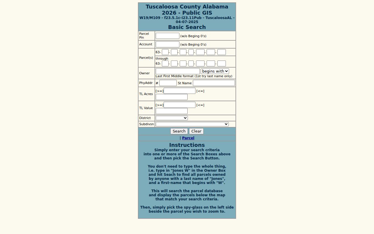
The captured screen makes the key distinction visible: `PhyAddr` is the parcel location, while an owner's mailing address is a different fact.
Northport Street Record Channels
No single roll is a full directory of a Northport street. The county and city divide the evidence by purpose. Web access is convenient, yet older instruments, custom city records, and some voter material require an account, a counter visit, email, or a formal request.
| Address-keyed source | Custodian | Useful result | Access route |
|---|---|---|---|
| Assessment roll | Tuscaloosa County Tax Assessor | Owner lead, parcel, physical address, district, subdivision | Free Basic Search or assessor counter |
| Parcel map | County Mapping Department | Parcel shape, adjacency, map context | Free GIS or mapping counter |
| Deeds and plats | Tuscaloosa County Probate | Transfers, legal description, source of title | Free-account portal, historical index, mail, or recording office |
| Voter information | Board of Registrars and Alabama Elections | Lawful registered-voter fields | Self-lookup or requested voter file |
| Address and permit files | Northport Planning & Inspections | Assignment, change, corner-lot orientation, responsive permit evidence | Form, email, or written records request |
The Mapping Department updates tax maps from deeds, plats, wills, assessments, and surveys. The maps serve taxation, not conveyance. A survey or recorded legal description controls when boundary precision matters.
Note: The assessor counter and Mapping Department at 714 Greensboro Avenue remain practical fallbacks when the Northport by-address portal returns an uncertain match.
Northport Address Terms That Matter
Street research becomes much clearer when each address field keeps its proper meaning. Northport's city form, the county roll, and the recorded deed do not use these terms as synonyms.
- Parcel
- A tract carried as a unit on the tax map. One apparent property can have more than one parcel ID.
- Situs address
- The physical location of the land or building, labeled `PhyAddr` in the county search.
- Plat
- A recorded plan that identifies subdivision lots, blocks, streets, and related land details.
- Criss-cross directory
- A directory organized by street or telephone number rather than only by surname. No exact local run was verified, so ask the library before relying on one.
Alabama's parcel format encodes map location, section, quarter-section, block, parcel, and subparcel. It can survive postal or street-label changes better than a typed address. Leading zeroes may disappear on a map, so compare the whole sequence rather than its typography.
Map Northport Streets Parcel by Parcel
The county GIS supplies the visual half of a street search. Run the physical-address search, choose the spy-glass beside a result, and inspect the parcel fabric around it. If the active map does not allow a useful adjacent selection, return to the street-name results and open parcels one at a time. The published instructions do not promise a radius tool, bulk owner export, or survey-grade boundary.
The county mapping page captured below explains the office behind these ownership maps.
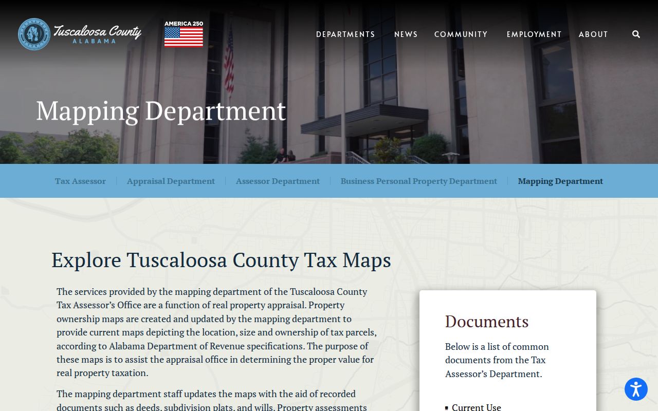
That provenance matters. Deeds and plats feed the map, while the parcel display remains a tax tool rather than a deed or boundary survey.
Carry Northport Streets Into Deeds
The Tuscaloosa County Probate Court does not document a direct street-address search for deeds. GIS must translate an address into an owner and legal identity first. In the free-account portal, choose DEEDS and enter a name as `Last Name First Name` without punctuation. Match the acquisition deed by legal description, plat book and page, or source-of-title book and page.
General name searching reaches from March 20, 1975 to current records. Earlier work continues under HISTORICAL INDEXES. Select DEED and a dated BOOK; Direct means seller or grantor, while Reverse means buyer or grantee. Free viewing and printing are documented after account creation. The recording counter, phone line, email channel, and mailed-copy route remain available when the portal is incomplete. Regular deed copies cost $1 per page, and certification adds $3.
This deed bridge turns a Northport address lead into a checked ownership chain. It still says nothing by itself about renters, relatives, or other household members.
Northport Voter Street Evidence
Alabama offers two very different voter channels. VoterView is for individual verification. It asks for first name, last name, date of birth, and a CAPTCHA, then advertises registration status, ballot status, polling location, and address. Its separate polling-place search takes one residential location. Those controls prevent a Northport street researcher from browsing a block or road through the self-service screen.
A full voter file follows a formal request path. The posted form allows county, city, or district scope and includes residence-address and political-district choices. An address-oriented sort may be requested, but the Elections Division must confirm what it will provide. The 2026 amendment to Alabama Code §17-4-38 took effect June 1, 2026. It excludes listed identifiers, requires timely electronic provision, limits reproduction cost, and restricts sale, publication, and commercial use. Current law controls even where an older posted form still shows legacy fields.
The Tuscaloosa County Board of Registrars is the local fallback for registration records and questions. Its office is at the Courthouse Annex, 2501 7th Street, Suite 200, Tuscaloosa; phone 205-464-8415. A voter-list hit proves registration evidence, not every occupant, and voting history records participation rather than ballot choice.
Northport Mailing and Situs Clues
A mailing address says where correspondence goes. A situs address says where the parcel lies. An owner can receive tax mail elsewhere, and a Northport parcel can therefore show two very different places. A matching mailing and situs address, especially with homestead evidence, may support owner occupancy. It does not name every person living there.
Tax timing adds another trap. Tuscaloosa County bills a year in arrears, and an October bill carries the person who owned the parcel on the prior October 1. A sale after that date can leave the former owner on the bill. Always compare the most recent recorded deed before naming a current owner.
Keep both addresses. Record physical and mailing fields under their exact labels; merging them can place a Northport owner in the wrong home.
Northport Assigns Street Addresses
Northport Planning & Inspections provides the local bridge when an address was created or changed. The Address Request Form accepts new-address, change-of-address, and other requests. It ties the request to a parcel ID, subdivision and lot, records the owner mailing address, and distinguishes residential, commercial, mobile-home, cell-tower, utility, and other structures.
Corner lots receive special care. The form asks which street the front door faces. That orientation may explain why a building appears under a different road than expected. Completed material may be sent to addressing@cityofnorthport.org. No public online index of every historic request or permit was found, so the sensible fallback is a focused request to Planning & Inspections that identifies the parcel, address variants, and sought date range.
Northport Street Names Across Time
A modern by-street search can miss an older entry because the name changed. Northport's museum history documents a sharp example: the 1907 Palmer house stood on Tanyard Street, now 10th Street. Search both labels. Historical Northport also appears as Kentuck or Canetuck, North Tuscaloosa, North Port, and Northport, so catalogs and maps should be tested under each form.
The University of Alabama historical county-map collection shown below includes a 1919 Map of Northport and other area maps.
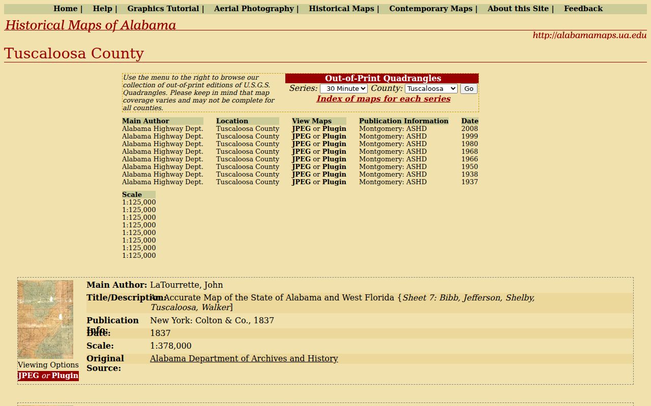
The 1919 map can bridge an old road label to today's parcel work. It is also safer than assuming Tuscaloosa Sanborn sheets cross the river, since no Northport-titled Sanborn set was verified.
Northport Street Directory Limits
Property records identify assessed owners and land. They do not list every occupant. VoterView confirms one voter's own status and polling details through a name, birth date, and CAPTCHA; it is not a public street browser. A requested voter list covers registrants under statutory rules, not all residents, and never reveals ballot choices. Utility-customer and motor-vehicle address data are not substitute resident rolls.
Older directories have limits too. A 1922 Polk volume titled for Tuscaloosa includes many Northport people, yet entries may say only “Northport” without a numbered address. Later street-guide or criss-cross sections may help, but no authoritative local run was established. The collection details belong on the Northport directory book page.
Lawful use. Use Northport address records for family history, property research, civic questions, or personal safety. Never use them to stalk, harass, intimidate, or harm anyone.
A careful Northport address result labels each claim. Owner, taxpayer, registered voter, directory resident, and household member are separate categories. Write down the source date because rolls and deeds change at different speeds. When a person may be at risk, respect protected records and every valid confidentiality restriction.